
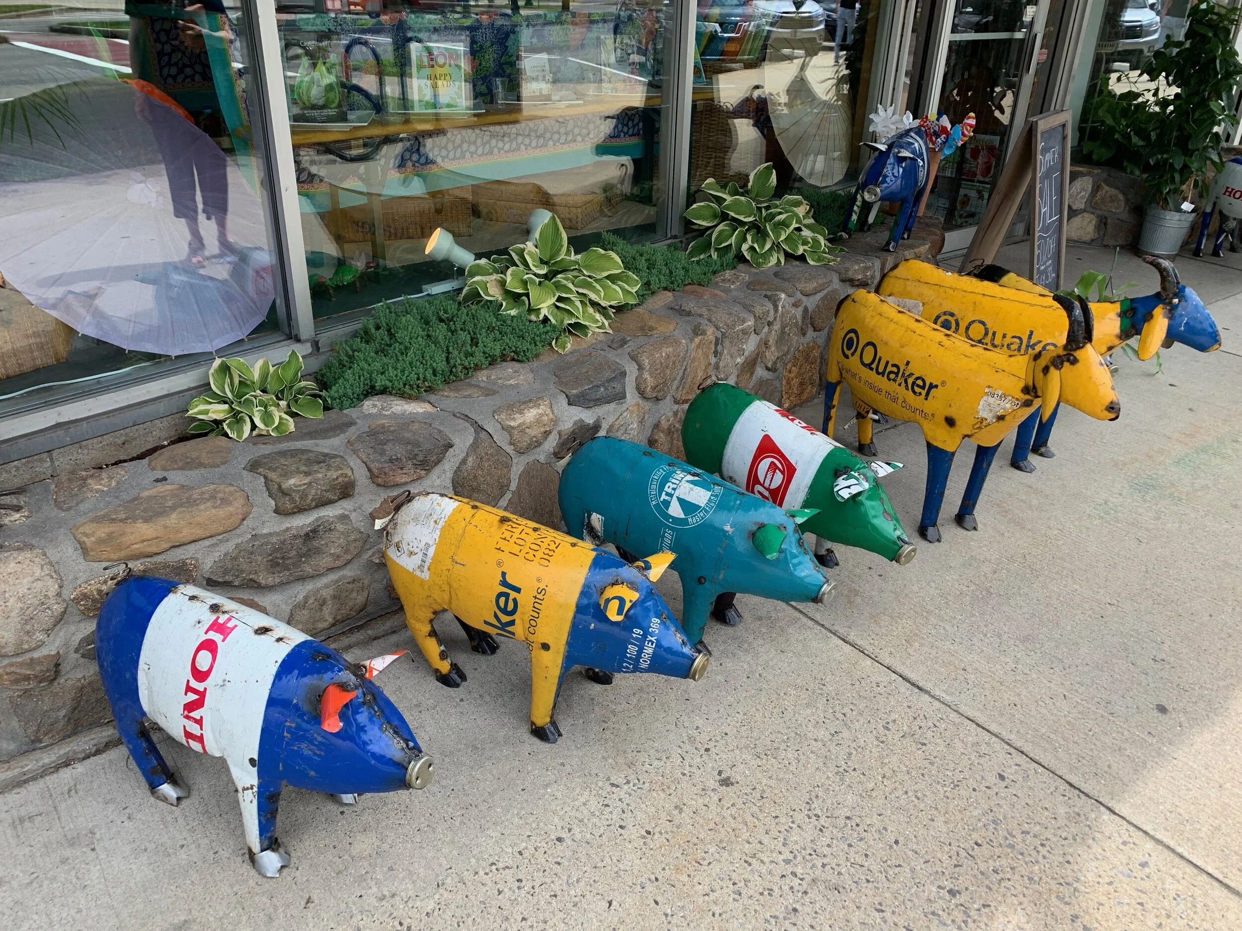
Houston Rides

There are probably very few people who would choose as their dream bicycle destination, Houston, Texas. Yet, many of us find ourselves in Houston for reasons of business, conferences, meetings, conventions, or, as was the case with us recently, a new grand baby. We have been working with several Houston bike shops on seasonal/reciprocal group rides: Houston in winter, Boston in summer. While most of us don’t get to choose when to go, the lucky ones will be there in the winter when the temperatures are generally in the mid-sixties. Getting out of a nasty New England winter is a big plus. And, if you’re in Houston, it’s necessary for your mental health to get out of the air conditioning and into the fresh air.
First of all, we recommend you fly into the more easily navigable Hobby rather than the very large and hectic George Bush airport. There are hotels galore – look online and see what you like. We find the Mariotte’s there very clean and BIG (Everything is big in Houston) and surprisingly not that expensive. There are over fifty(!) bike shops in the greater Houston area as well as several bike clubs that hold weekly rides.
On our recent trip in October, we rented a couple of bicycles from some friendly folks at Bike Barn Buffalo Bayou Rentals near the Brays Bayou of all places.


We started out in one direction but ended up turning around as part of it was under construction. The trail itself is in good shape – asphalt, paved – and it runs along the Brays Bayou (a bayou, for you northerners, is basically a slow moving stream) in southwestern Houston, running through neighborhoods, universities, and even mid trail the Houston Zoo and the city’s museum district. It was nice to get out on bicycles and the day was stellar. We wore our street clothes. Quite a few road crossings involving intersections and heavy traffic impeded our progress at first. There are traffic lights; however, we do recommend making eye contact with the drivers before crossing rather than trusting the lights. The trail improved as we went west with neat suburban homes on our left and the bayou with flowers and wild grasses to our right. We didn’t have much time, so we only rode maybe twelve miles. The total path length is is 33.8 miles so you could easily make a day of it.
Buffalo Bayou Park is a 160 acre green space located just west of downtown Houston. The bike trail stretches 15 miles and is fully paved. It includes beautiful gardens and pristine landscaping, hike and bike trails, bike rentals, dog park, public art, two visitor centers, many places to picnic and relax and plenty of eating places to choose from. One of the nicest things about this trail is even though you are surrounded by magnificent views of skyscrapers, you don’t have to cross streets; there are
bridges and underpasses that allow you to stay on your bike! I particularly appreciated the unique sculptures and outdoor art along the trail. You do need to watch out for pedestrians and rollerbladers; it’s a popular trail! There are two bike rental shops nearby: Bike Barn at The Water Works and Houston BCycle.

Ashuelot Rail Trail
In the mid-1800s Keene, N.H. was a manufacturing center, serving as a hub for three railroads: the Manchester & Keene Railroad, the Ashuelot Railroad, and the Cheshire Railroad. With the decline of the railroads in the twentieth century, the Ashuelot and Cheshire Railroads were transformed into rail trails.
The entire trail, called either the Cheshire Rail Trail and/or the Ashuelot Rail Trail depending on which direction you go, is about 42 miles long.
We started in the center of Keene, where we had booked a very nice, spacious and clean room at the Mariott. On our way to our room, we noted a Starbucks in the lobby, a big plus. The rail trail literally runs through the hotel parking lot so the beginning of the ride entails a wee bit of in-town navigating, but folks in cars were mindful of bikes, courteous, and the crosswalks are clearly marked. The Ashuelot trail (not sure how to pronounce that), which is 21.5 miles long, follows the Ashuelot River south to Hinsdale in southern N.H. I rode a hybrid and Bill was on a gravel bike, both of which were just perfect. My slightly fat tires and a bit of suspension proved to be very comfortable on the variety of surfaces we encountered. Mountain bikes would also be fine; I wouldn’t recommend a road bike, as the terrain is multi surface: paved, gravel, sand, roots, grass, pine needles, just about everything.
The trail started off paved in town and continued over a very old bridge over Route 101, either side lined with Black Eyed Susans in abundance, the effect being flying on a bike through a Van Gogh painting. Pavement turned gradually into gravel for several miles and eventually to more gravel, then dirt, then smooshed grass. The terrain and surrounding land is surprisingly varied: shaded woods, lush pastures sometimes with offshoots into people’s backyards, farmland, soft pine needle paths, trestle bridges over the river from time to time. All in all a fabulous ride, predictably unpopulated on a Tuesday afternoon. Much of the trail looked as though it got a lot of use in the winter with snowmobiles. We didn’t make it all the way to the end, although after our ride, I found out that in the town of Ashuelot, there is a covered bridge built in 1864, considered one of New England’s most sophisticated covered bridges with a span of 169 feet and featuring intricate latticework. Next time! A note of caution: five or so miles out of Keene, the trail crossed road three times with no cross walks. Be careful! The road was curvy and the traffic was fast, so you have to be alert.

We searched in vain for a wine store in Keene, a college town; apparently the N.H. state liquor store is just five minutes away on the highway, so if you want a decent bottle of wine for the room, think ahead. For dinner, Bill found a first rate restaurant within walking distance of our hotel, called Luca’s Mediterranean Café.
Owned by Luca Paris and his wife, we highly recommend it! Great wine list, vegetarian options, delectable entrees and desserts. Also pleasing interior, friendly servers, and a very snazzy ladies room.
In the morning, we found a hippy dippy breakfast sandwich shop called Brewbaker’s café where I ordered a custom sandwich (egg, cheese, tomato, onion), fortifying me for a lengthy browse at Eagle Books, a used bookstore owned by the charming Sylvia Felix.
A wonderful mid-week trip ;-)
Ashuwillticook Rail Trail

The word “Ashuwillticook” is a weird name, right? It is from the Native American name for the south branch of the Hoosic River and literally means “at the in-between pleasant river.” Makes sense.
The eponymous Rail Trail is a former railway (built in the 1800’s) converted into a ten foot wide paved rail trail path, running parallel to Route 8 through the towns of Cheshire, Lanesborough and Adams, Massachusetts.
We began our ride from its southern end where the trail begins near the entrance of the Berkshire Mall, creepily deserted in an end-of-the-world sort of way. The well-maintained trail runs north next to the Hoosic River, passing between the majestic Mount Greylock and the Hoosac Mountains 12.2 miles to the center of Adams. The trail was practically deserted that day, but it is used for walking, biking, jogging, and rollerblading. At times along the way we noticed that the trail was bigger and in better shape than the local roads.
At one point the Hoosic River splits into The Berkshire Pond and The Cheshire Reservoir, charming bodies of water. There is some cool homespun architecture along the way, homes that look as if they’ve been built by hand over decades. One such featured a mannequin out front -- clearly a Patriot’s fan, running shoes inexplicably fastened to the outside of the house, and two toy tractors on the roof, among other fascinating objects artfully arranged.
Also of interest to us were the abandoned factories in the process of being swallowed by nature (i.e. feral cats and raccoons). We also spotted the fabled “Black Sheep” but never did discover which family was associated with it.


We did not make use of the many benches strategically placed to allow maximum visual beauty (sparkly water, colorful leaves) because we were starving and had as our destination The Coffee Liberation Front, which is conveniently located across the street from the end of the trail in Adams. Score. Homey place and homey food (no meat, Thank God) run by the charming duo, Chris and Andrea. Andrea was mostly a blur in the back, clearly operating the food end of the operation, while Chris, a largish fellow with glasses and pony tail (think: David Foster Wallace), was the friendly face behind the counter. According to his T-Shirt, his superpower was the ability to make beer disappear. Impressive, I think? We lingered for over an hour, so I had the opportunity to notice that he not only knew nearly every customer by name, but they all seemed to be friends. By the end of our stay, we were friends too -- we took a picture and promised to spread the word. The downside was that we had to leave the warmth. But not to worry, as always (Thank you Chef John), the trail is downhill in both directions.
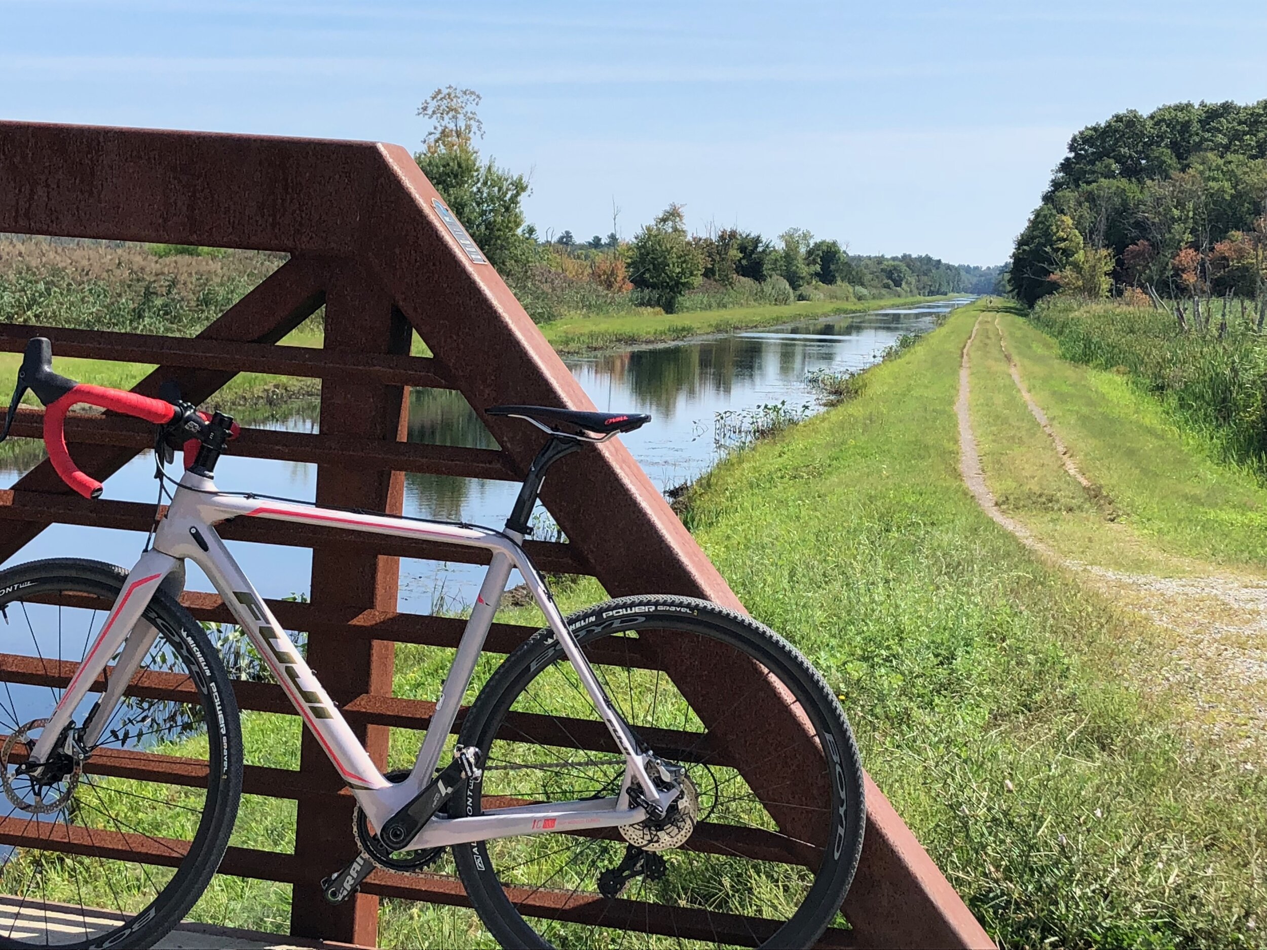
Nashua River Rail Trail

The Nashua River Rail Trail is a 12.5 (20.1 km) paved multi-use rail trail that runs north from Ayer, MA following the course of the Nashua river, passes through Groton, Pepperell and Dunstable, MA and ends about a mile across the NH border in Nashua, next to a little pond.
The line originally opened in 1848 as part of the Worcester and Nashua Railroad that connected Worcester, MA to Nashua NH. It was later extended to Portland, ME. Passenger service ended in 1934 and the last freight train ran in 1982. In 2001 and 2002, the trail was paved and is open to bikers, runners, rollerbladers, strollers, dogs, and horses. In fact, there is a somewhat confusing sign that appears from time to time that directs folks via graphics and arrows who is to yield to whom. Bottom line is everyone yields to horses, no surprise there. That said, we’ve ridden this trail on bikes a bunch of times, and have never seen a horse.
Like most of the Massachusetts rail trails, there is almost no perceptible change in elevation end to end; the actual grade never exceeds 2%. Fast ride without hard pedaling. Remember: we like to coast. The trail goes through wetlands, ponds, woods, and farmland where, if you pay attention, you can spot beavers, herons, and frogs.
Along the route, you will see ancient-looking granite mile markers from when the trains ran. If you are the kind of person who likes to check the bike computer against the markers, you’ll be happy to know that my Garmin Edge GPS computer proved super accurate.
One nice feature for folks from Boston and its environs is the proximity: it’s only about an hour’s drive to Ayer from the North Shore. There is plenty of parking associated with the rail trail on both ends, although we’ve only ever gone from south to north, and there are Porta-potties but I wouldn’t recommend them. Plenty of woods if the need arises. Not many folks use this trail even on the weekends, but if you want less company the best time to go is on a Tuesday or Wednesday.


There are quite a few rest areas with benches and serene views along the way and about three quarters of the way to Nashua, you pass through the town of Pepperell, a small bustling town with places to eat and drink. Speaking of drink, look for the weirdly placed fully functional old-fashioned soda vending machine on the side of the trail in the middle of the woods!
And speaking of food: There are several places to eat in the town of Ayer which might be okay, we’ve never tried them, because we found a gem of an Italian Restaurant called Filho’s Cucina in nearby Groton, a few miles to the north. This charming place features hand painted walls and tables and chairs, cheerful servers, and a liquor store connected next door where you can purchase a bottle of wine to enjoy with your meal. The Lobster ravioli and shrimp is to die for. And best cannoli ever. Large portions and fresh ingredients. You need to replace your carbs!
As always: Have a great ride.
…and let us know how it goes.
BSquared Crew.
Here is a link to : Filho's Cucina
Norwottuck Rail Trail
There is something otherworldly about riding your bike on the Norwottuck Rail Trail; it’s paved, there are no cars, and it’s pretty straight, so you can see far into the distance. The (few) bumps in the road are outlined in white or yellow, a feature I appreciate. While I’m riding, sometimes I feel as though I’m in a scene of a movie that I’d actually like to watch. I’m normally a 12 mile an hour type of rider, and although I don’t go any faster on this trail, it feels as if I’m going 20 because it’s downhill in both directions. I know that doesn’t make sense, but it feels true.

Starting in Northampton, Ma., the route runs northeast, crossing the Connecticut River on a quarter mile of wooden bridge. And let me tell you, zipping over the river at 100 feet above the water on a converted railroad bridge is a real hoot. The trail is 11 miles in one direction cutting through lush marshland, pine forests, and cornfields; you are surrounded by birdcalls, the wet scent of flowers, and if you pay attention, you will spot the occasional beaver lodge (they’re called hummocks, I hear).
There are several cafe stops along the way if your caffeine or sugar levels need managing; and if you bring your own supplies, there are myriad places to rest with artful benches and peaceful lookouts.
If you want the trail to yourself, mid week is the best time to go, with only the occasional dog walker or roller blader or biker to wave to. Watch out for suicidal frogs.
For an overnight, we recommend the Hotel Northampton, a stately, elegant hotel that sits across the street from the beginning of the trail. Some of the rooms feature a balcony overlooking the town where you can enjoy, after dining downstairs (I recommend the scallops and the creme brulee) the rest of the bottle of wine.


The Norwottuck is only one of three rail trails that begin in Northampton. The Manhan rail trail runs southwest for ten and a half miles and the Northampton bikeway runs north for six miles on packed gravel. Rising at 2-3% grade on the way out of town means that you can coast all the way back. (We love to coast).
Post ride the food options are truly global: Pizza joints, Tibetan, Mediterranean, Japanese, Vegan, Seafood, Tea shops, Bakeries and about a thousand coffee shops.
Enjoy!
Let us know how it goes.
Topsfield Linear Commons
The Topsfield Linear Commons rail trail runs south from just north of Pie Brook Road in Topsfield all the way to Lowell street in Peabody. In our opinion, it’s best to avoid the Peabody part and start in Danvers where there are fewer traffic crossings (although there are several in Danvers before you get out of town) and it is def. more woodsy. We like to park at the Cherry Street Fish Market where there is a conveniently-placed porta potty (just in case), and where we enjoy lobster and crab rolls and potato chips post-ride on bright blue picnic tables facing the trail.
While the trail is not paved, it is smooth enough for a road bike; that said, hybrids, comfort bikes, and mountain bikes are even better (more comfortable).
If you happen to be on a mountain bike there are quite a few inviting side trails begging to be explored. If you do stick to the trail, there are a few road crossings, equipped with handy flashing lights activated by buttons with signs that read sensibly, “Push button to activate crossing lights.” Very convenient, that.
The trail through Danvers, after you get past the roads, winds through quiet neighborhoods and over little bridges and past playgrounds. You will not be alone: there will be folks running, walking dogs, walking babies, biking, roller blading, shuffling. In our experience, all are friendly if you smile first.
Approaching Topsfield, civilization becomes less evident, and crickets and birds and squirrels take over. Once you cross route 97, it’s even better, with wild flowers and marsh land on both sides. At one point, if you take a right going north, you will hit the Wenham canal, a meandering body of water lined with grass on both sides that extends for about two miles from the Ipswich River to the Wenham pump house. I grew up in Wenham and never knew it was there until 2 years ago.
If you’d rather park on the north side, there is a lot next to the Catholic Church in Topsfield. If you are lucky and it is a Sunday, you might catch the last stanzas in the song of the praise band (this must have been the informal service). Very stirring.


Also in Topsfield, whether you park there or ride there, be sure to visit The Bake Shop, a charming one room bakery (no bathroom, be forewarned) featuring smiling teenage girls, killer pastries and better-than-church basement-coffee (actually, a lot better). Beware the fruit tartlets (three is not enough). If The Bake Shop is closed, as it was this past Columbus Day weekend, there is a breakfast place called Daybreak Cafe and Lunch on the door of which we found a handle labelled (aptly) “Tony’s Handle,” although we could not find Tony, and besides, the line was too long.
But. You know what? We’d rather have lobster rolls anyway. It’s only 7 miles back. Maybe less.
The spirit of the Commons rail trail is expressed by a post declaring in 8 languages: “May Peace Prevail on Earth”
Amen to that ;-)